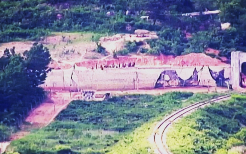
North Korea is reportedly accelerating the construction of barriers within the Demilitarized Zone (DMZ) that began in April, according to recent satellite imagery.
On August 23, Radio Free Asia (RFA) reported, based on an analysis of satellite images from the private satellite service “Planet Labs,” that a long concrete structure is now visible near the Military Demarcation Line (MDL) in Goseong County, Gangwon Province.
RFA compared these images, taken on August 9, with photos of the same area from June 17. The analysis revealed significant progress in the construction of what appears to be an anti-tank barrier. While the structure was previously observed in scattered segments, it has now formed a nearly continuous line over the past two months.

Jacob Bogle, a civilian satellite analyst, told RFA, “There has been substantial progress in the construction over the past two months,” adding that it seems unlikely the barrier will extend further within Goseong County.
Although some barrier sections remain disconnected, Bogle explained that these gaps are likely in areas with natural defenses, such as mountainous terrain, or along coastal regions where water could accumulate after rainfall if barriers were built.
Additionally, the satellite images revealed new anti-tank obstacles over two key transportation routes—the Donghae railway and the Wonsan-Kumgangsan highway.
A South Korean military official previously stated in June that since April, North Korea has been carrying out various activities in the northern DMZ, including creating wastelands, laying mines, reinforcing tactical roads, and constructing unidentified structures that appear to be anti-tank barriers.
At that time, military authorities assessed that North Korea was building anti-tank barriers within the DMZ. Observers believe these actions are likely aimed at enhancing border defense capabilities while also strengthening internal control measures to prevent defections.
BY YOUNGNAM KIM [kim.youngnam@koreadaily.com]


